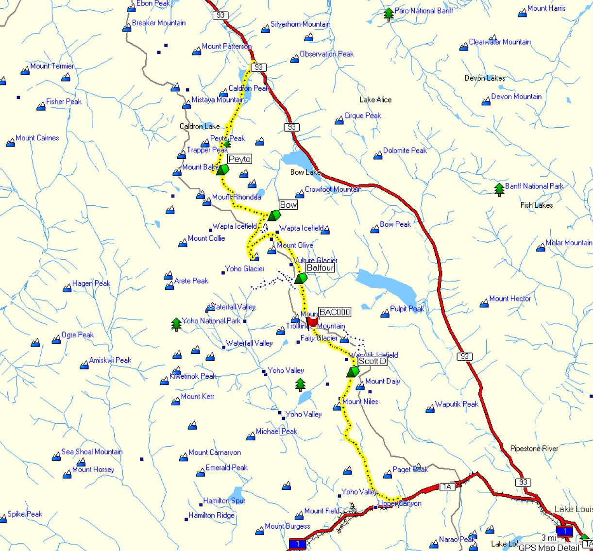
We undertook this classic ski mountaineering tour of the Wapta icefields in the Canadian Rockies spring 2008, starting at Peyto Lake in the north and traversing the Peyto glacier, Bow glacier, Vulture glacier, and Balfour glacier, finally exiting in the south at the Trans-Canada highway. The group was made up of John, Tom, Lino, Mark, Robin, and Steve. We took a couple extra days to play and explore, making seven days and six nights in total for a great backcountry ski experience. Route descriptions, GPS waypoints, etc., can be found under Routes and Descriptions.
According to the Alpine Club of Canada (ACC):"This world-class winter ski-mountaineering destination is a spectacular journey across the Wapta and Waputik Icefields, providing you with fantastic views, amazing glacier runs, and the ultimate backcountry experience."
Our trip got off to an inauspicious start - one team member had all his luggage sent to Timbuktu via Smolensk, another (unnamed) forgot his passport and missed the flight to Calgary. As a result the first day (Friday) we split with Tom, Mark and Steve heading into the Peyto hut and John, Lino and Robin regrouping with plans to head into Bow on Saturday. A late start from Peyto Lake meant we had to move quickly to the hut but otherwise the day was nice weather and uneventful. The hut was busy but not full and we had a pleasant first evening on the glacier.
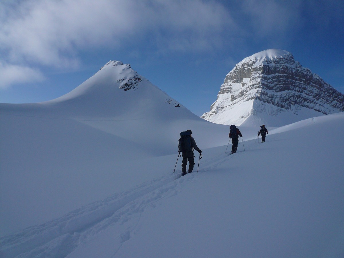
Saturday was nice weather with passing clouds and some snow flurries. The trip from Peyto to the Bow hut was quick and uneventful (although in white-out it would be a challenge). Mark, Tom, and Chris (who had portered food for an ACC group) decided to climb St. Nicholas. The climb along the knife-edge ridge was exhilirating. (Looking back afterwards the ridge appears almost inaccessible.) As luck would have it visibility was good before and after the climb, but during everything was socked in. John, Lino, and Robin surmounted the numerous travel problems and arrived at the Bow hut by about 6:30. We had a very pleasant dinner with John and Shelley.
Sunday the weather was again decent with passing clouds. Our complete group made a side-trip to Mt. Gordon and were rewarded with beautiful views. For the trip to the Balfour hut we split with Tom, Robin, and Steve taking the standard route via the St. Nicholas - Mt. Olive saddle onto the Vulture glacier. Tom and Robin dropped packs at the Balfour hut and went out for a little exploring. John, Mark, Lino traveled to the Balfour hut via the Vulture col.
We had a lay-over at the Balfour hut for Monday, but the weather had turned with blowing snow and very low visibility. We headed down Waves Creek and found surprisingly good skiing and visibility at lower elevations.
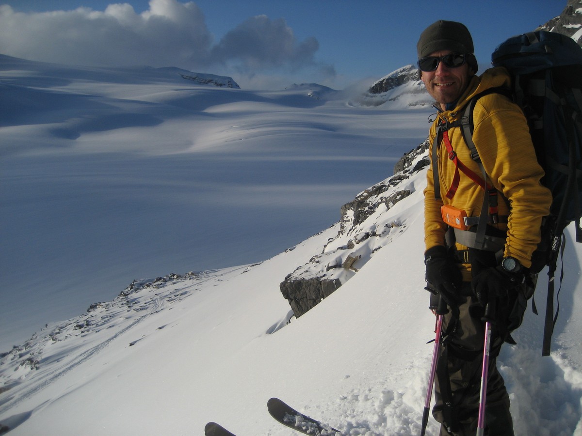
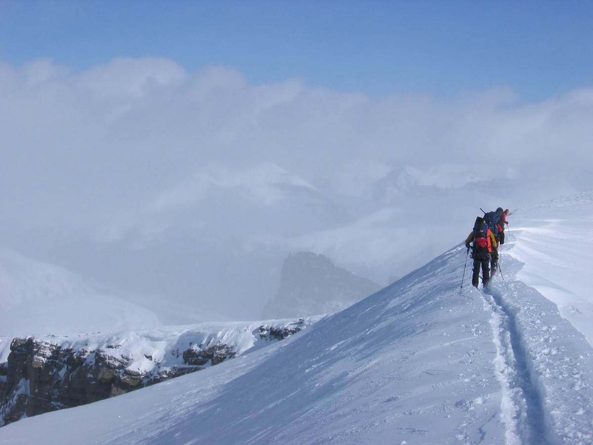
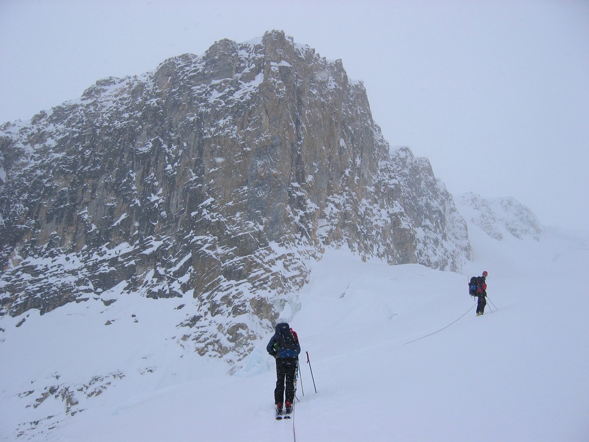
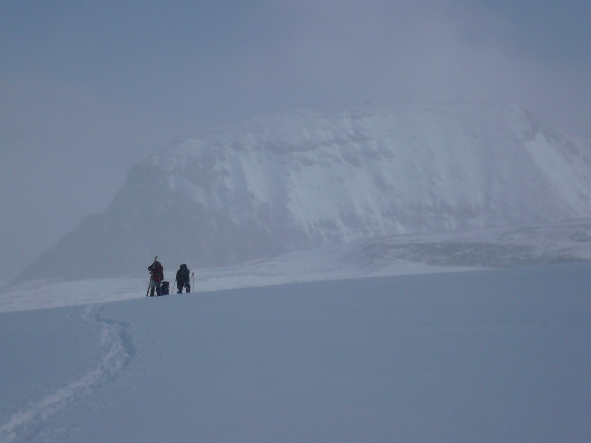
Tuesday we planned to tackle the Balfour high col, rightfully considered the most difficult day of the classic traverse. As luck would have it the weather was still poor although improved from Monday - visibility between 200-1000m all day with snow off-and-on. The visibility was enough for close navigation (eg avoiding crevasses) but not enough for sighting major landmarks. We relied on GPS quite a bit, and accurate waymarks here were invaluable. We had a little trouble finding the best way to access the Scott Duncan hut, missing the easy ramp from the NE and instead climbing up from the SW.
Once again, the visibility on Wednesday was poor but it was not snowing or blowing hard. We had another lay-over day and decided to ski over to the Balfour glacier. There was enough new snow that avalanche concerns made us cautious and we only got a few mild runs in. A group of seven joined us in the hut for the night. Since the Scott Duncan hut is the least spacious of all the huts this made for tight (and warm) conditions.
Thursday was our exit day and it was finally clear. We left late (about 9 or 9:30) allowing the other group to get out first. By the time we hit Niles it was a little warm for comfort. The ski down to Sherbrooke Lake was fun. The last one or two kilometers down to the road was narrow and fast - a real luge run.
The Wapta icefields are west of Banff along the continental divide on the Alberta / BC border. We did the classic traverse, starting at Peyto Lake in the north, hitting the Peyto, Bow, Balfour, and Scott Duncan huts and traversing the Peyto glacier, Bow glacier, Vulture glacier, and Balfour glacier, finally exiting in the south at the Trans-Canada highway.
The route is on glacier for almost the complete traverse, from the
Peyto hut through the Scott Duncan hut, and avalanche danger is always
a concern. As such it is not a minor undertaking, and should be
considered only by groups experienced in avalanche
risk evaluation and glacier travel and crevasse rescue. The Alpine Club
of Canada maintains huts on the glacier.
These are not heated (except for the Bow hut) but do have propane
stoves and lamps, and are actually quite comfortable. The huts must be
reserved through the ACC.